Institute Lands & Princeton Battlefield
Open daily, dawn to dusk
(609) 734-8000 Google Maps Trail Map GeoPDF
Gravitas: ![]() Challenge:
Challenge: ![]() Proximity:
Proximity: ![]()

Communing with Einstein
The Institute Lands are a uniquely Princeton institution. Where else, in less than a square mile, can you walk in context of TWO seminal aspects of human history?
- the Continental Army’s 1777 victory, arguably the key turning point in the United States’ war for independence, and
- the early 20th-century revolutions in physics (relativity and quantum mechanics) that enabled the development of both nuclear and electronic technologies.
Not to mention a lovely, small bird sanctuary tucked into the SE corner of the preserve.
That this is almost all on private land makes it very Princeton. A couple of generations ago, with no fanfare, the Institute for Advanced Study decided to keep these lands open to the public, and so they still are. This includes not only the trail system in the woods, but also the open farmland to the west, and the pond and grounds next to the main Institute campus.
Of course, the Institute is best known for being the institution that offered Albert Einstein a home on the eve of WWII, and where he worked until his death in 1955, frustrated with his inability to develop a quantum gravity theory. Today the Institute still employs some of the best physicists in the world, frustrated by the same problem. Who knows? The person you pass on the trail might be the one who ultimately cracks the puzzle, or else a world class academic in any of the many disciplines the Institute supports.
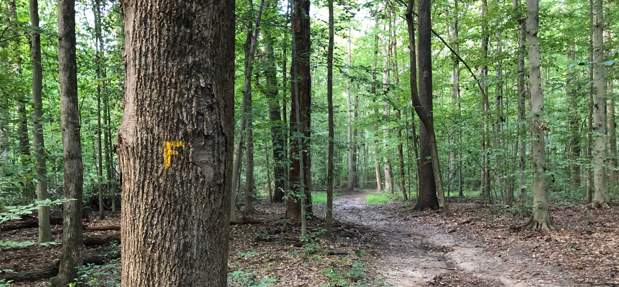
The trail system itself is a bit quirky, starting with the blazing system. Most of the trails in the park are wide, flat, and easy to follow. A few of the trails are named, and sport unusual blazes. For example, the “Founder’s Trail” gets blazes that look like a Yellow F. The pipeline trail gets horizontal white bars (i.e. presumably representing a section of white pipe on its side). The Trolley Trail (on a short section of the path of a trolley that ran from Princeton all the way to Trenton at the turn of the prior century) gets a red U (presumably a horse shoe symbol). However, even on the named trails, the blazing is hit and miss, and many trails are completely unnamed and unblazed. Navigation isn’t too bad, since most trails run in a grid, but the GeoPDF map properly installed in your cell phone is definitely helpful.
This is one of the top destinations for X-C skiing in the area. The flat, wide trails are perfect for beginner cross country skiing any time there’s a snow cover of 8″ or more. Princeton outdoorsy types usually show up in fair numbers, effectively setting tracks (even though there’s no one “grooming” the area). It’s a perfect place for beginning XC skiers, and for more advanced types to warm up to more challenging fare.
The trail system interconnects with the Rogers Wildlife Preserve (a lovely bird sanctuary) tucked into the eastern end of the Lands (just SW from Turning Basin Park). You can cross a suspension bridge over Stony Brook to interconnect with the D&R Canal State Park (a linear trail that connects New Brunswick with Trenton). And adjacent to the Institute, you can walk to the Princeton Battlefield Park. Some of the key aspects of the battle took place elsewhere on Institute Lands, which you can read about here.


Bean
I live about 20 mins south of Trenton and have been driving up into Princeton every couple weeks for a part time gig and only now that the time has changed I can actually get a glimpse of what all is nested in this region in the way of beautiful natural landscape and parks. I am desperate for new places to go that won’t take all day to get to, just for strolling or picnicking and one of my main interests is in finding a well manicured pond area such as this where I can picnic on warm evenings. Good to know, just might take a ride up today to see what it’s like! Thanks for sharing 🙂