

Abbott Marshlands: John A. Roebling Memorial Park
Sunrise to Sunset, 365 days/year
(609) 303-0700 Website Google Maps Trail Map GeoPDF
Gravitas: ![]() Challenge:
Challenge: ![]() Proximity:
Proximity: ![]()
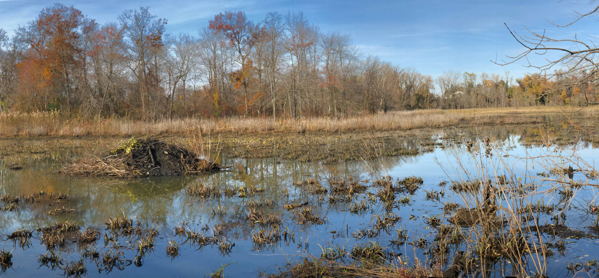
If you’ve ever driven south of Trenton on Rte. 29, you’ve probably noticed that the interchange with Interstates 295 and 195 is built in the midst of a major wetlands. The area, known alternately as the Abbott Marshlands, or on earlier maps as the Trenton-Hamilton-Bordentown Marsh, is a 1,250 acre protected wetlands and wildlife preserve, and home to several parks. For hikers, the most important is the John A. Roebling Memorial Park, operated by the Mercer County Parks Commission.
Mercer County has invested heavily in the park in recent years. The park is an essential resource if you bird-watch, paddle, or enjoy warm-water fishing. For hikers it’s not quite so essential, but it’s a fascinating place to spend a few hours exploring, and will expose you to an ecosystem that you’ll rarely experience. My wife and I visited it for the first time together recently, and just loved it.
For hikers there are two useful trailheads: the Spring Lake Trailhead off Sewell Avenue, or the Watson Woods Trailhead off of Westcott Avenue. The two are less than half a mile apart by foot. If you intend to walk the entire trail system (about 3.5 miles or so) you can start either place. If you want to visit the Tupelhaking Nature Center as well, then the Watson Woods trailhead is the place to start.
There are 4 interconnected trails for hikers:
- The walking/cycling track around Spring Lake, and its connector to Watson Woods. While this is nearly a flat rectangle, there are lots of places to duck off the trail to view the Marshlands to the west, making it quite entertaining. By itself, not including the Watson Woods connector, this is 3/4 mile. The connector adds 1/4 mile.
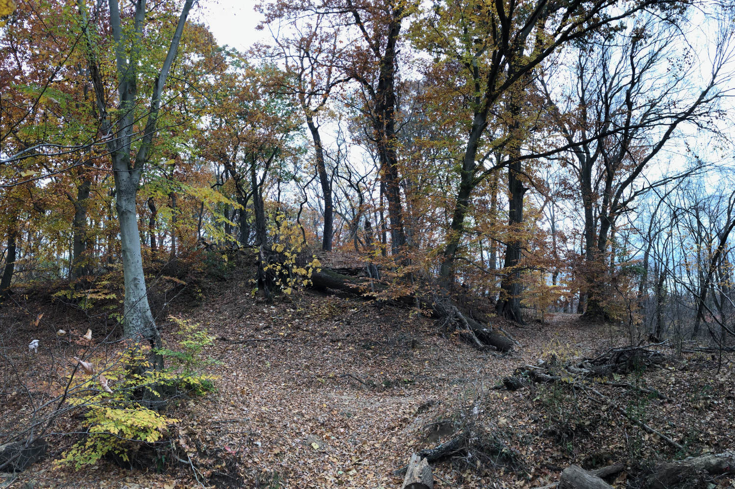
- The Orange/White trail system on the heart-shaped island just SW of Spring Lake. It’s a pleasant stroll through the woods, and a remarkable contrast to the marshlands. Also many places to sneak views, especially along the south rim. Walking the periphery of the island on both Orange and White trails, while skipping the Orange Dot trail in the center, is about 1.1 mi.
- The Red-blazed Abbott Bluff Trail. From the gravel park road, it’s about 3/10 of a mile to the “summit” of the Bluff, and up about 70 vertical feet (bear right when the trail splits). This climb (and the linear return) represents perhaps the prettiest section of trail in the entire system. The return loop, however, is disappointing, providing closeup views of the side of a strip mall on the other side of Independence Ave, and the back yards of some 1960s tract homes. My suggestion is not to complete the loop, but to turn around before reaching Independence Avenue. Even though you’ll be returning the way you came, the change of direction provides a different set of rewarding views of the much more attractive eastern branch of the trail.
- The Yellow-blazed Abbott Creek Trail. These woods offer the occasional, ancient tree, and the Abbott creek drainage is fascinating if not always picturesque. There’s a well designed crossing that most hikers should find easy to traverse.
Leave a Reply