

Baldpate Mtn: Eastern Trails
Open daily, dawn to dusk. Closed for deer hunting Wed-Sa from early Dec to mid Feb.
(609) 989-6559 Website Google Maps Trail Map GeoPDF
Gravitas: ![]() Challenge:
Challenge: ![]()
![]()
![]() Proximity:
Proximity: ![]()
Note: We love Baldpate Mountain so much, we’ve written four reviews about different aspects of the park: 1) Overview, 2) Switchback Trail, 3) Eastern Trails (this review), 4) Pine Grove Hike. In addition, Fiddler’s Creek Preserve has been added on the other side of Fiddler’s Creek Road.
Go East, Go East
The Eastern Trails of Baldpate Mountain recently received some major improvements. Some of the less-used trails, which were always poorly maintained, have now been closed. Meanwhile, the main route from Church Road to the Pleasant Valley Parking Lot sports new, green blazes, improved boardwalks by the Church Road trailhead, and newly excavated drainage channels along the upper stretches of the Kusar Mountain trail.
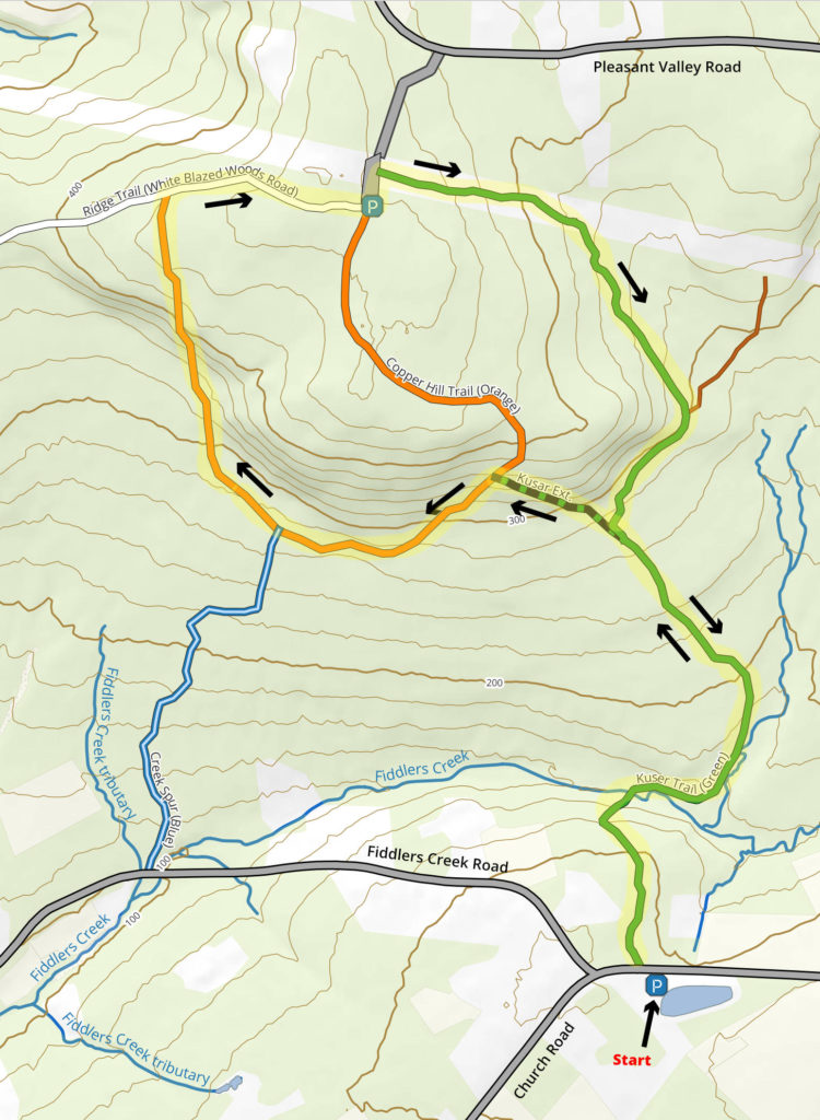
One of the nicest hikes in the park is now to start at the Church Road trailhead, just east of its intersection with Fiddler’s Creek Rd. Follow the Kusar Mountain Trail and a complete a partial loop by connecting via the Kusar Mountain connector (formerly the Honey Hollow trail), then a branch of the Copper Hill Trail, returning via Kusar Mountain.
Either branch of Copper Hill is worth exploring, though the western branch (as mapped here) is substantially more challenging. It is also wetter during spring, or after a substantial rainstorm. If you want to take the western branch, I suggest walking it uphill (north) as a steep slope makes downhill footing somewhat treacherous. The eastern branch is 10-15 minutes shorter, saves a steep descent and even steeper climb, and provides easier footing.
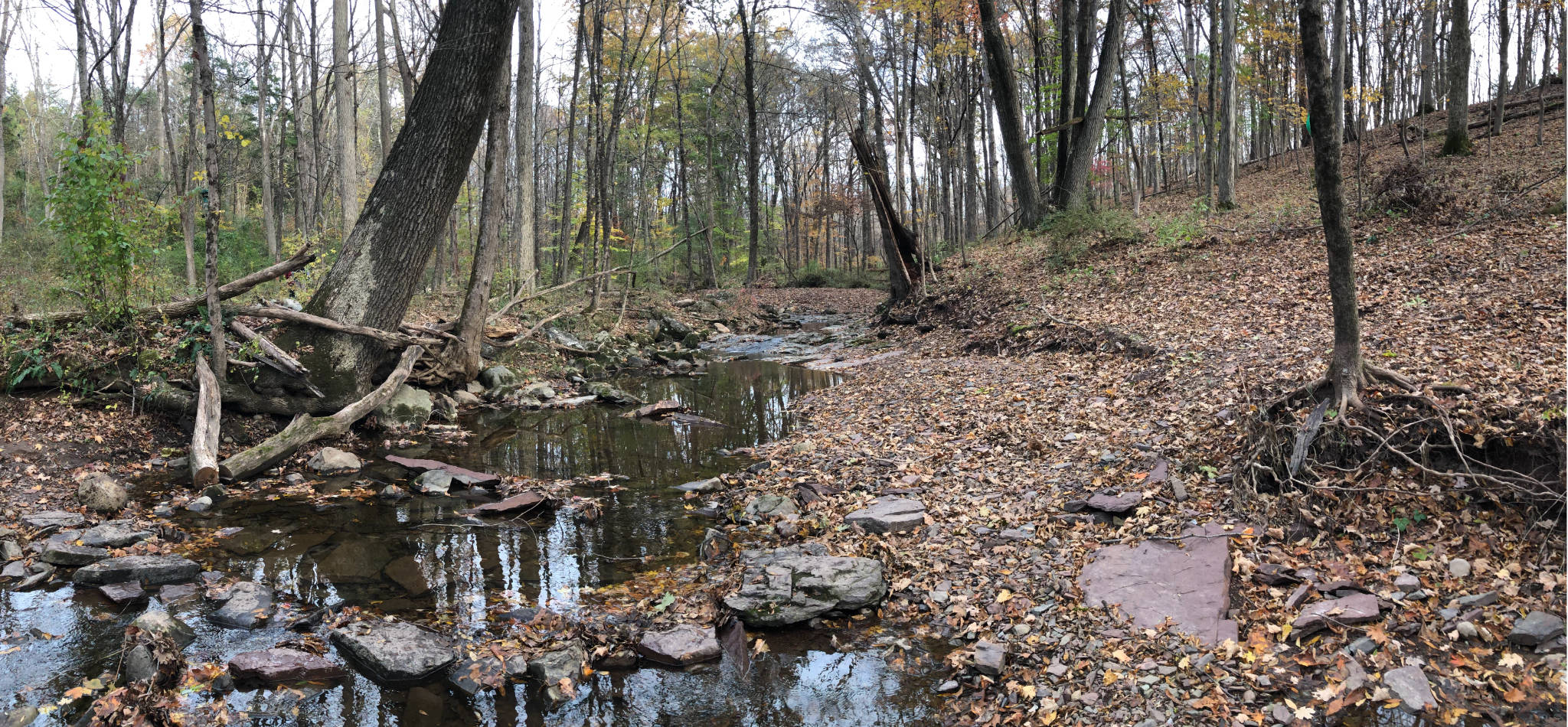
During wet season, you still should expect wet conditions. Crossing Fiddler’s Creek is now via barely improved stepping stones. In summer conditions you can stay completely dry. During spring high water, you may want to give it a miss. In the spring and fall, ankle-high Gore-Tex boots are a very good idea when it’s wet, especially if you’re taking the western branch of the Copper Hill Trail.
Leave a Reply