

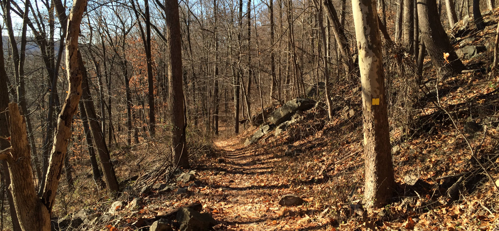
Baldpate Mtn: Switchback Trail
Open dawn to dusk year round. During hunting season (Dec-Feb) closed W-Sa.
(609) 989-6559 Website Google Maps Trail Map (GR Series)
Gravitas: ![]() Challenge:
Challenge: ![]() Proximity:
Proximity: ![]()
Note: We love Baldpate Mountain so much, we’ve written four reviews about different aspects of the park: 1) Overview, 2) Switchback Trail (this review), 3) Eastern Trails, 4) Pine Grove Hike. In addition, Fiddler’s Creek Preserve has been added on the other side of Fiddler’s Creek Road.
Most Aerobic Walk
In 2010, the Mercer County Parks folks opened up a the “Switchback Trail” in the Ted Stiles Preserve at Baldpate Mountain, which enables the most aerobic walk in the area. Ascending 425 vertical feet in around 6/10 of a mile, it achieves the greatest vertical gain of any single trail in Mercer County, and an average gradient of around 13%. By comparison, the Summit Trail (Blue Blazes) delivers 325 vertical feet in around 1.2 miles (it starts about 100 feet higher), for an average gradient of 5%. We’ve rated this walk for Experienced hikers due to elevation gain, though fit Intermediate walkers should have no trouble completing this route as the footing is generally good (though lower sections can be muddy).
By combining the climb up on the yellow-blazed Switchback Trail with a descent down the Main Park Road, a climb back up the Blue Blazed Summit Trail, and the north loop on the Red Blazed Trail, you can achieve a cumulative elevation gain of nearly 1,000 vertical feet (well, OK, 950) in a 90 minute walk. There’s no other walk of which I’m aware that delivers anything like that much vertical elevation in the local area. Congrats to the Mercer County Park people for doing this.
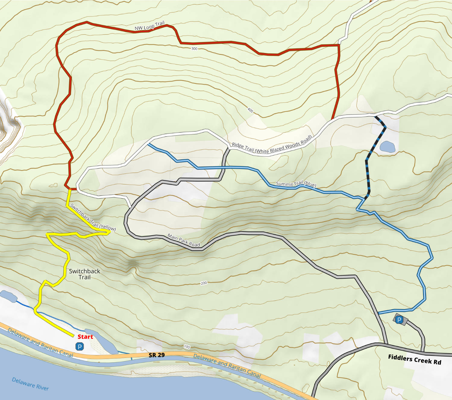
This map is derived from our latest trail map that works in Avenza Maps (a free application) that turns your smartphone into a wilderness GPS. Be sure you download and install the map before you go!
Jon Lambert
Thanks for your excellent description of this wonderful place. My wife and I had hiked the mountain a couple of years ago, but we could not remember how to access it, and, as you point out, the park system does not make it clear. We’ll be up there soon!
Don
Thanks for the 411! For a long time, there were no real quality or lengthy hikes in Mercer County. The explosion of open space preservation in Hopewell Township has changed this, and now I am glad to see this new system (well, relatively new) to add to better hiking closer to home. And the added parking information you give is golden, its almost impossible for someone to figure out how exactly to access the Baldpate mountain trails. Good work!
Jim
Thanks for this suggestion. I recently discovered this park and it is the best hike in Mercer County. Kudos to Kevin Bannon and the rest of the staff at the Mercer County Park Commission. They are doing a great job making available a lot of great outdoor opportunities here.
Gary
No question about it, this is the best hiking in Mercer County! My wife and I have been hiking Baldpate since we discovered it back in December, and we hike more often now since hunting season is over. In addition to the trails shown on the map, there are several trails not shown that connect to these, and they are excellent as well. The various combinations of trails always makes for an interesting hike. The Mercer County Park Commission has a real winner here!
Dina
Thank you for the excellent hiking guides, especially this one. This is not only a great workout, but incredibly fun! The full rock scramble (think it was part of the blue trail) was an unexpected treat and there was an amazing view of the woods just up past the scramble to the left.