Greenway Meadows / Stony Brook Trail
Open daily, sunrise to sunset
(609) 924-4141 Website Google Maps Trail Map GeoPDF
Gravitas: ![]() Challenge:
Challenge: ![]() Proximity:
Proximity: ![]()

22 Minutes and We'll Give you the World
It took me 22 minutes to drive to the trailhead parking lot from Trenton. Once on the trail, you’ll find yourself in a wild, tranquil world where everything seems to be right. No small feat.
I wrote that in 2013. Returning in 2021, I found an even more compelling trail, benefiting from thoughtful extensions from 206 to the Trolley Line north of Johnson Park School, and exquisite development of the D&R Greenway education center.
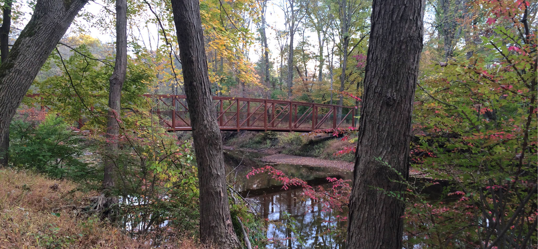
Stony Brook Pathway now extends all the way to Stockton St/Rt. 206. You can park in a small lot on Hutchinson Drive, walk past the Jasna Polana Golf Course, and cross two bridges to reach the main Stony Brook trail just below the Hun School athletic fields.
Alternatively, you can start in the middle, at Greenway Meadows Park on Rosedale Road. This option is the most flexible, as you can easily decide how much you feel like walking. If you walk the entire trail system, it’s longer than you’d think: starting from 206 and walking all the way north to the Trolley Line loop, then returning via Greenway Meadows and back along Stony Brook, totaled 7.2 miles according the track on my GeoPDF map. BTW, that does NOT include the Poetry Trail loop, which is charming in its own way.
Whichever way you choose, much of the trail tracks Stony Brook within its flood plain. This preserved a swathe of undeveloped land through some of the most valuable real estate in New Jersey. However, when the leaves are up on the trees, you’re barely aware of the suburban development that surrounds you. It’s truly remarkable.
The trail itself is pretty much dead flat, easy to follow (though mostly no longer blazed), and (except for the occasional root sticking up) provides easy footing. Wherever there is any kind of obstacle, and there aren’t many, there are helpful steps or boardwalks. Some of these improvements had been wiped out the by Tropical Storm Ida in 2021, but the trail remained easily passable for the most part. The trail does get muddy in places during wet season.
The trail used to continue along Stony Brook without a break under the Rosedale Road bridge. That part of the trail is no longer maintained, even though some of the maps you’ll find on the Internet show it thus. Small snippets of that trail still survive, but other parts are a tangled mess. You’re essentially bushwhacking. We’ve left it off of our field-tested, GeoPDF map (link in the header).
However, the preserve north of Rosedale Road remains well worth exploring, but you access it via a trail that starts east of the river on Rosedale Road. You can either duck off the river and up the cycleway to Rosedale Road, then turn east, or cut through the D&R Greenway Meadows complex. Either way, you’ll want to walk north and then around the Red Path loop (which is the only consistently color-blazed trail in this complex). I was surprised to see the ruins of an old bridge over Stony Brook which clearly supported the Trolley Line to Trenton, and even more surprised to run into kids playing on an appropriately rustic jungle gym hidden just off the path.
This hike is is lovely for everyone, but particularly suited to Beginner hikers and for excursions with young kids. The stream is generally fairly shallow, the current isn’t swift, and the bottom is reasonably firm, making it a good place to explore aquatic life.
To date, we’ve reviewed four trails that run along Stony Brook. This is my favorite.


Nancy Gene Horkay
Only about a 10-minute drive from where we lived in NJ.