Herrontown Woods, All Saints & Autumn Hill
Open Daily Dawn to Dusk
(609)921-9480 Website Google Maps Trail Map GeoPDF
Gravitas: ![]() Challenge:
Challenge: ![]()
![]() Proximity:
Proximity: ![]()
Where the Whole is Less Than the Sum of its Parts

Writing this review was a struggle because the whole of these three preserves is less than the sum of its parts…
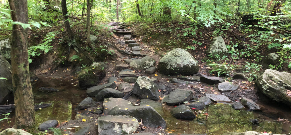
Herrontown Woods sits in the center, and is charming. The trail system is well marked, and while there are no expansive views, there are many micro-views to enjoy including well-executed stream crossings, a mysterious boulder-field, and a “haunted” cottage. Really, my only issue is that it’s too small.
In theory, the interconnections with the All Saints Preserve, from the south, and the Autumn Hill Reservation, to the north, should fix this, but somehow don’t, though for different reasons.
All Saints Preserve features two straight-forward trails running the length of the preserve, with a convenient spur to the Church Parking lot. It’s a dense, little woodland parcel, mostly wetlands, and while the trails are well built and well blazed, there’s nothing particularly charming about them. If access from All Saints Church is more convenient for you, then the spur trail in particular adds some value. Otherwise, having walked the All Saints trails once, I have no particular interest in returning.
The Autumn Hill Preserve should be better than it is. The property lacks the charm of Herrontown Woods, but the NW corner delivers some elevation change (nothing dramatic, but around 100 feet in total), and a few interesting micro-views result. But the biggest problem is that the trails are terribly marked. There are a few trees on which little metal markers survive, but not enough to be useful. Where did they go? I presume stolen as souvenirs. But it makes navigation extremely challenging unless you’re using one of our GeoPDF maps, and even then it’s not as easy as you’d think.
How so? Here’s something that happened to me last week when I was field testing the newly-created map. I had followed a spur trail to the pipeline, which was accurately mapped on the GeoPDF, then turned around to double back. Since the trail down had been quite distinct, I returned on “automatic pilot” simply following the clear path. What I didn’t realize is that there was a side trail, not on my map, built by a local to provide access to their neighborhood. They’d cut a log to clear the footpath. Walking back, the log cut caught my eye and I made an “automatic” (but incorrect) left turn. It took me about 5 minutes to realize I was off course (since I wasn’t checking the map; had I been checking regularly, it would have been obvious within a hundred feet or so).
I had the GeoPDF map on my phone, and I was running the tracking (a really useful feature), so I could see what was wrong (though not why until I fully doubled back and saw the cut log). But the absence of proper blazing is a real problem here. The mistake was disorienting enough even with the GPS. Trying to navigate with only a paper map here would have been extremely difficult.
Bottom line, I can’t recommend Autumn Hill in its current condition, except to experienced hikers, and even then it begs the question, “Why bother?” Apparently the public agrees, because the trails are overgrown, supporting above average tick habitat. Frankly, someone needs to sit down, design a colored-blazing system, and execute it with a few quarts of oil based paints and map it properly. Then people might enjoy using the Reservation, usage will increase, and the trails will open up a bit from use. Then maybe we could recommend it in combination with Herrontown.
Still, based solely on on Herrontown Woods itself, we’ve rated this walk 3-hearts.


Leave a Reply