

Tohickon Valley Trail System
Website Google Maps Trail Map GeoPDF
Gravitas: ![]() Challenge:
Challenge: ![]()
![]() Proximity:
Proximity: ![]()
Last of the Tohickons
Just 45 minutes from Trenton, across the river in Bucks county, is a spectacularly-scenic ridge-hike along Tohickon Creek (Tohickon is a Lenape word meaning “deer bone”).
In recent years the trail system has been substantially upgraded, with a new loop trail-blazed on the eastern end of the park, and what have previously been a hodge-podge of unblazed and unmaintained trails now integrated into a rational system. Don’t get me wrong, there are still a lot of mysterious trails leading off the main routes (some marked on our map, others not), but you can now achieve a fully satisfying, reasonably strenuous hike while sticking to the blazed system (which wasn’t true a decade ago). If you download our newly updated GeoPDF map, you should be able to navigate throughout the park readily.
Because of these improvements, we’ve upgraded this area to 5-hearts and suggest, if you haven’t been recently, to visit anew.
Basically, there are three parallel trails across most of the park:
- Blue – easiest, running mostly along the ridge top with almost no elevation change. For hikers, this is a good route for returning if you’re exhausted. Otherwise it’s boring as tears.
- Yellow – an intermediate trail that strikes a good balance among scenic value, relatively easy footing, and minimizing elevation change.
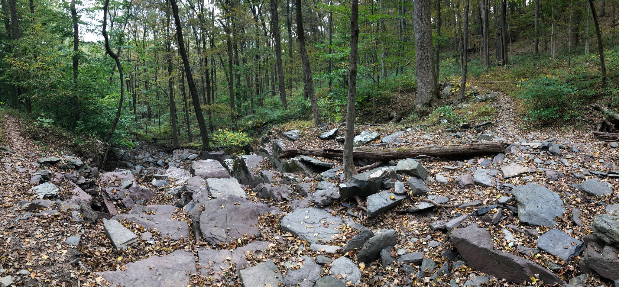
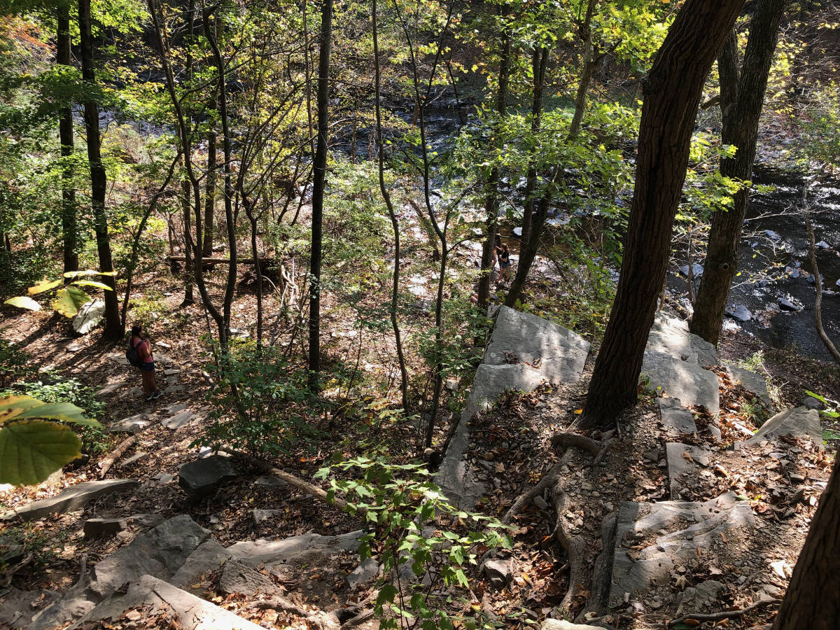
- Orange – the most challenging level for advanced hikers that will make you work but delivers some amazing views and micro landscapes, and gives you access to the stream (marked with fish on our map).
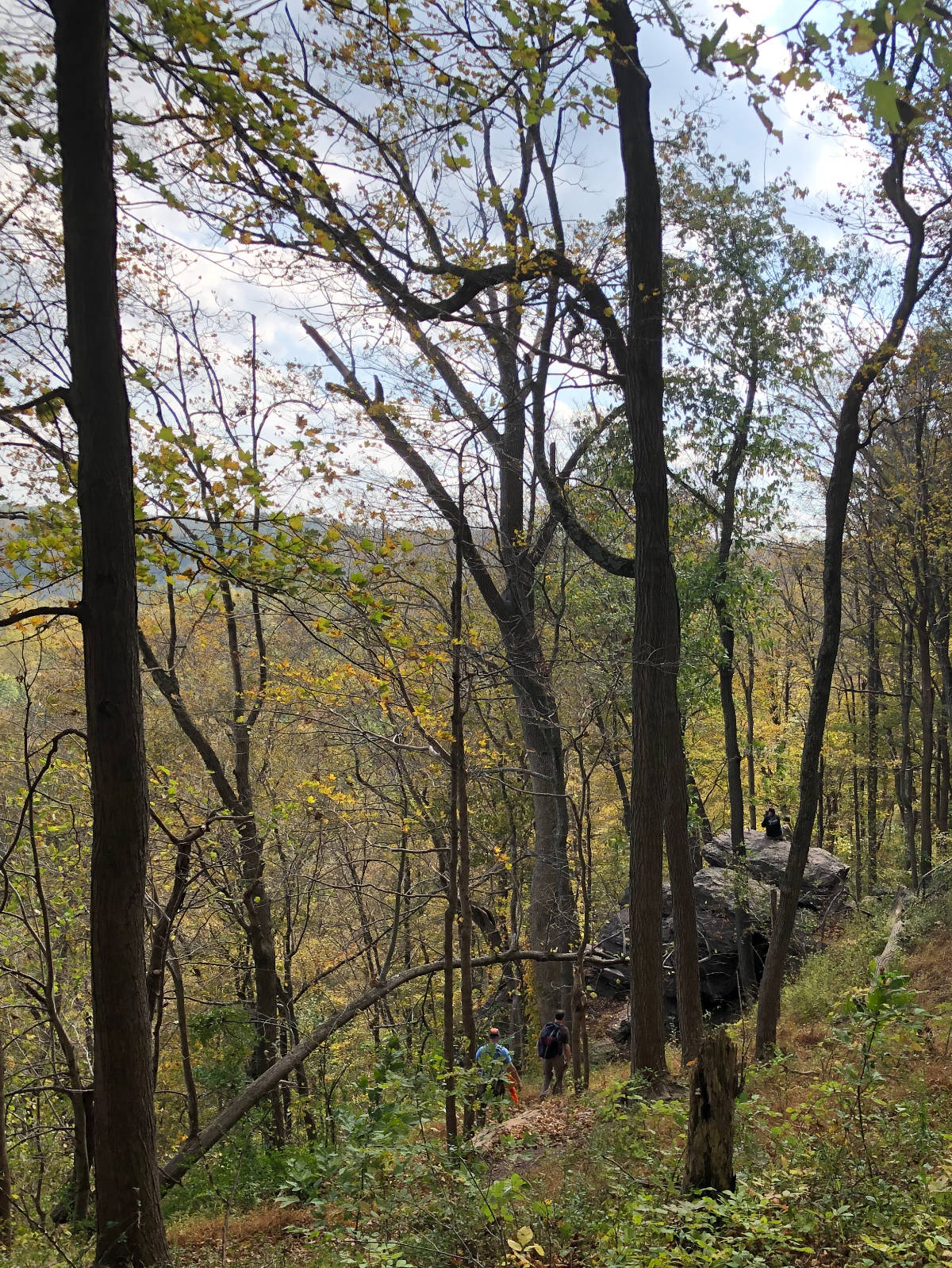
In the fall and winter, with the leaves down, you can walk in continuous views of the creek, and of the hills on the opposite side of the valley. In places, the trail overlooks steep cliffs, where you can get a clear view of the creek, as well as hawks perched on the ledges and flying along the valley.
There are basically 3 principal places you can park to start this hike. We’ve listed Tohickon Valley Park’s main lot in the header which usually has ample parking, and is a good place to start if you intend a longish hike. The orange trail that starts near there is the most challenging section of the trail, with switchbacks crossing talus slopes, so be warned. The small parking lot by the High Rocks section fills up on weekends as it’s the only convenient place for rock-climbers to access the cliffs with their gear. However, for hikers, it gets you to some of the spectacular parts of the hike more quickly and is really convenient if you’re looking for a quick, exploratory hike. Ralph Stover park is a reasonable alternative to High Rocks. It’s actually on the other side of the Tohickon, but provides a foot bridge crossing. However, it does require a brief walk up Stover Park Road (which is closed to vehicle traffic at the crossing).
You might want to hike with a fishing rod. In the spring, the Tohickon is stocked with trout. In the spring and summer, it offers pretty good smallmouth fishing. You can fish at Ralph Stover Park (recommended during stocking season, though there will likely be other fishermen around), or you can carry the rod along the trail. We’ve marked a couple of points off the orange trail where you can gain relatively easy access to the water (more adventurous hikers can find more). These spots are not recommended if you’re trying to catch stocked trout, as they’re pretty far from where the stocking trucks will dump their loads. In any case, you’ll need a PA fishing license.
The drive from central NJ can take you through the Delaware River towns of Lambertville and Stockton (on the NJ side), and Lumberville, on the PA side. They are all charming in their own right, and have some first rate (if usually pricey) restaurants. You can drive out Sunday morning, get a first rate brunch, then work it off by hiking.
Jamie Peck
Just checked it out today. Awesome. Thank you Hidden Trenton. Whoever you are….lol
Matt
Hey, thanks for the clear trail instructions, there is a serious lack of maps for this area. Much appreciated, heading there now!