

White Oak Trail
Dawn to Dusk
(609) 777-3373 Website Google Maps Trail Map GeoPDF
Gravitas: ![]() Challenge:
Challenge: ![]() Proximity:
Proximity: ![]()
Oak Prelude
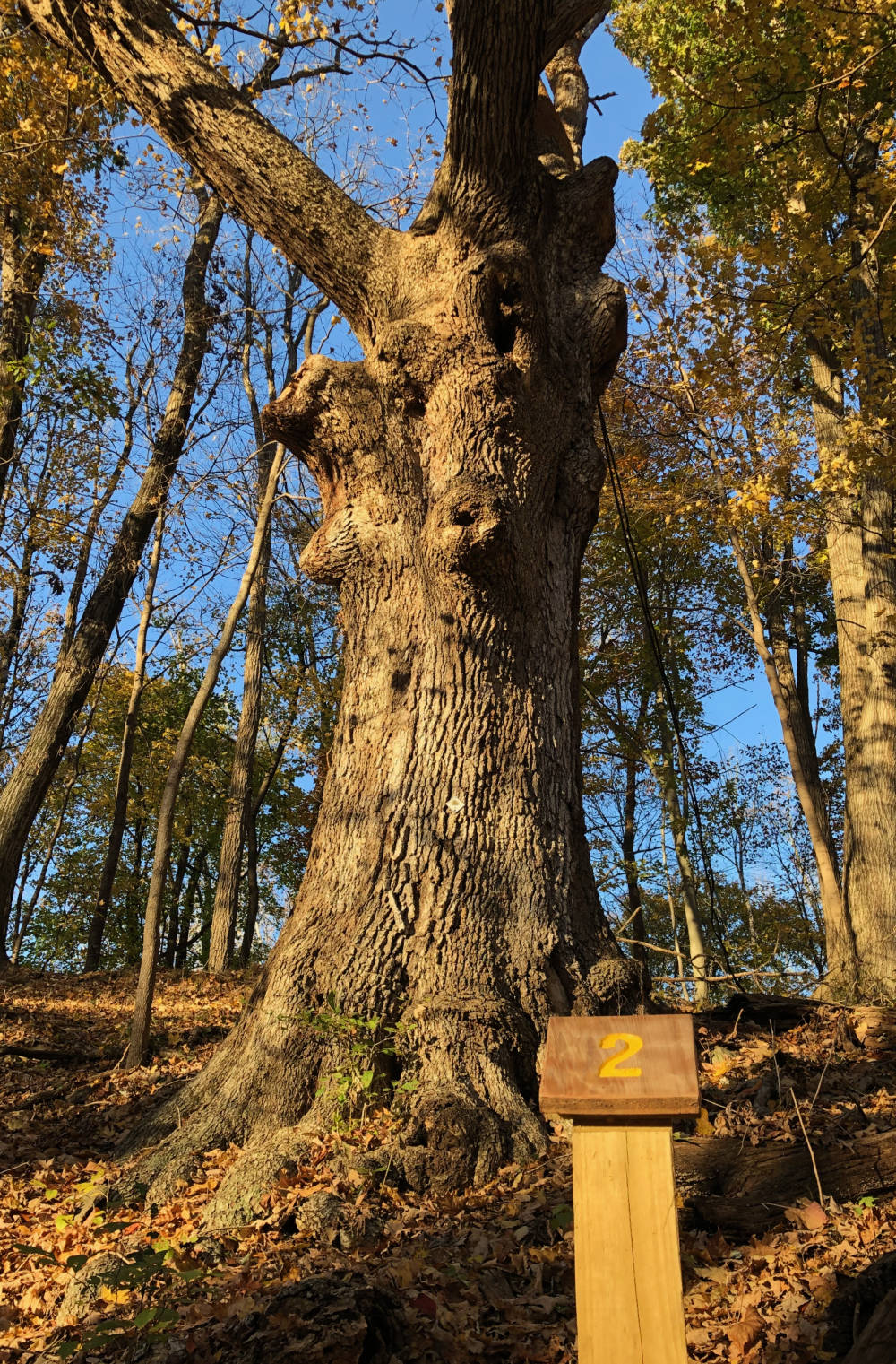
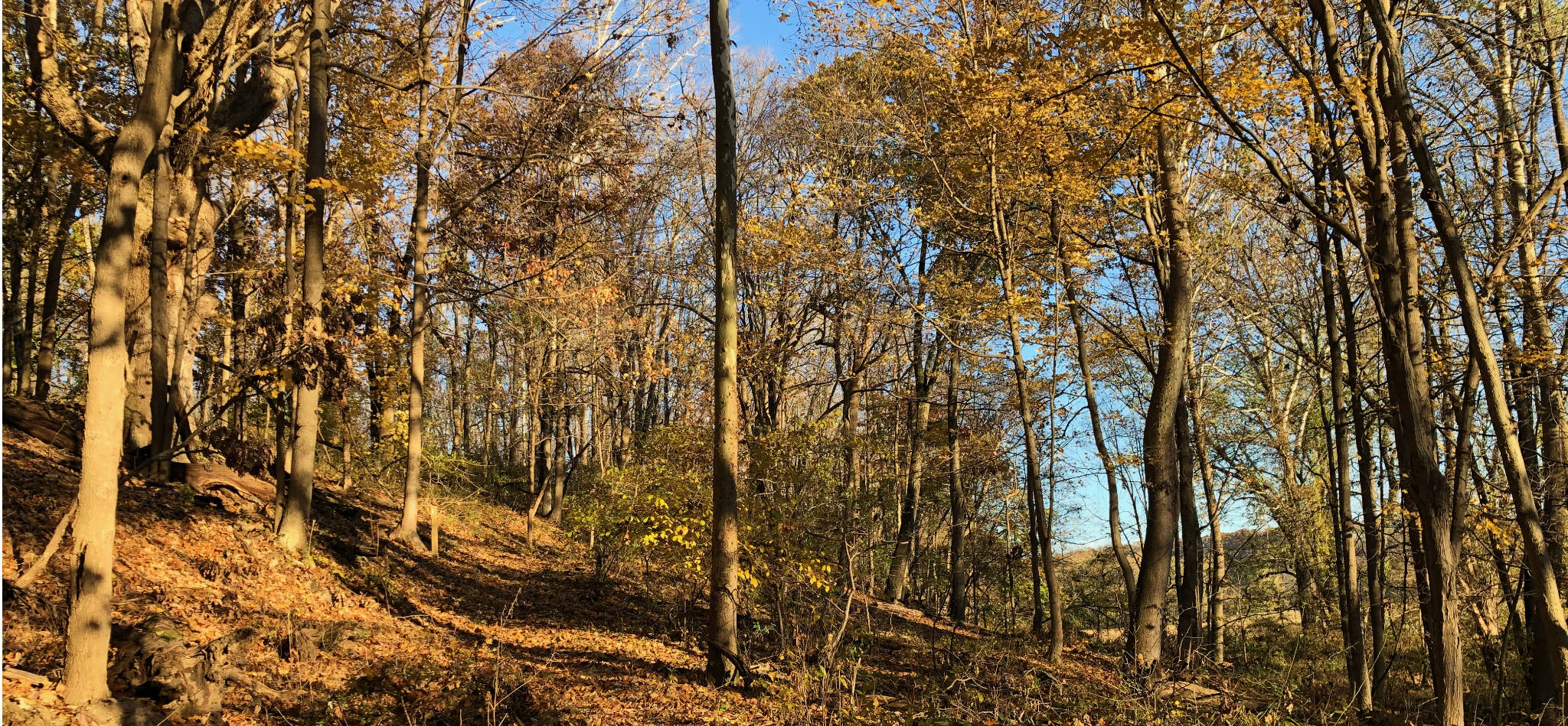
This is an odd little trail that starts by the Bull’s Island recreation area on the Delaware, and climbs for a mile before dropping you at the intersection of Federal Twist and Raven Rock-Rosemont Roads, about a quarter of a mile from the Zega-Lockatong Preserve trailhead. Along the way you will climb about 220 vertical feet, which is a fair amount for a central NJ hike, then lose 80 of them descending to Federal Twist Road. Sections of the trail are interesting: including some some impressive old trees and the remnants of an old quarry. In addition, it’s really a well built trail, presumably, originally service roads for the quarry operations. Footing is easy and the gradients are generally pretty even.
It’s just so short.
It’s definitely worth checking out the quarry. About 250 yards from the trailhead you’ll come to a point where the trail splits. The main trail is to the right, but nearly as well worn is the trail to the left. This heads to the old quarry pit. Particularly with kids it’s a must-stop.
As you continue to climb you’ll run into Quarry Rd, a little-used, gravel public auto-road. The trail continues along the road, about a 1/10 of a mile, then turns right to continue up the hill. On the way back, it’s worth wallking down quarry road, as it gives you another set of views of the quarry pit, this time from a higher viewpoint.
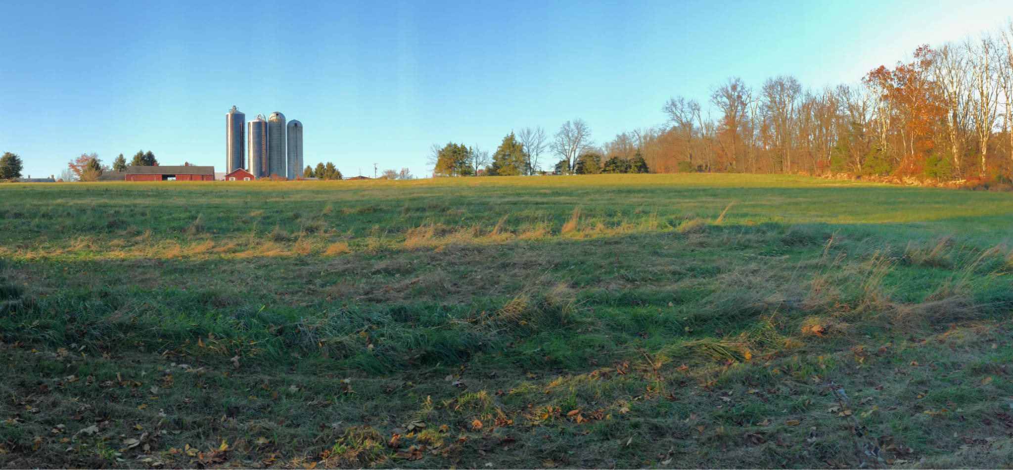
Above Quarry Rd, remnants of a more extensive trail system are evident. On our map we plot a loop trail from the Open Street Map, which we have not field tested. It’s not for lack of trying: we turned off when we saw a series of old white blazes very close to where OSM had mapped the upper junction. However, the blazes turned out to be marking a different trail which OSM doesn’t plot, almost fully overgrown, and climbing straight up another 120 vertical feet to a field and an impressive barn. I can’t recommend it, except for folks who really enjoy getting off the beaten path (literally). The brambles are thick (heavy duty long pants a must), and the footing is treacherous in spots.
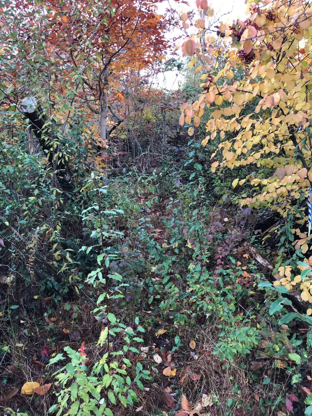
Who knows what else is up there? I looked for the OSM’s route on the way down, and did note an equally faded set of white blazes I’d missed the first time, which might have been the loop trail. However, by now the November sun was very low in the horizon, so I wasn’t prepared to explore it. Descending, I noted the lower junction where the loop rejoins the main path, which appeared exactly where OSM plotted it. A photograph of the trail is provided for your amusement.
It would be nice if the these trails were resurrected. Then this would be one of the more charming, small preserves in this part of the state. Not spectacular, mind, but worth hiking for sure. So why hike it now?
I can think of four reasons. First, if you’re in the area and time is limited. A pleasant, two mile hike with cumulatively 300 vertical feet of climbing might just be what you need. Second, if you’re a beginner or walking with kids and have never attempted a hike with some elevation gain with them, it’s a gentle introduction with easy footing (and some kid-friendly diversion along the way). Third, and probably the most compelling to most followers of this site, it’s a great way to add some extra mileage and elevation gain in combination with the Zega Lockatong preserve. If you’re in training, you could set off on a 7 mile round-trip with 600 vertical feet of cumulative gain, which is not easy to duplicate around here. Fourth, set up a car shuttle for a varied, beautiful, moderately strenuous hike that is truly rewarding.
Leave a Reply