

Zega-Lockatong Preserve
Open daily during daylight hours
(908) 237-4582 Website Google Maps Trail Map GeoPDF
Gravitas: ![]() Challenge:
Challenge: ![]() Proximity:
Proximity: ![]()
Stunning Walk-a-tong
Zega-Lockatong Preserve is the most beautiful small preserve in central NJ, and provides one of its best hiking trails. Unusually, it combines an extended stream-side hike with a 250 vertical-foot climb up a steep, wooded hillside.
Normally when I visit a new trail that I intend to review, I’ll take 4 or 5 pictures. The other day I visited Wickecheoke Preserve, which is unusually pretty, and took 19. Here I took 38: I kept running into beautiful places, and they kept getting prettier and prettier.
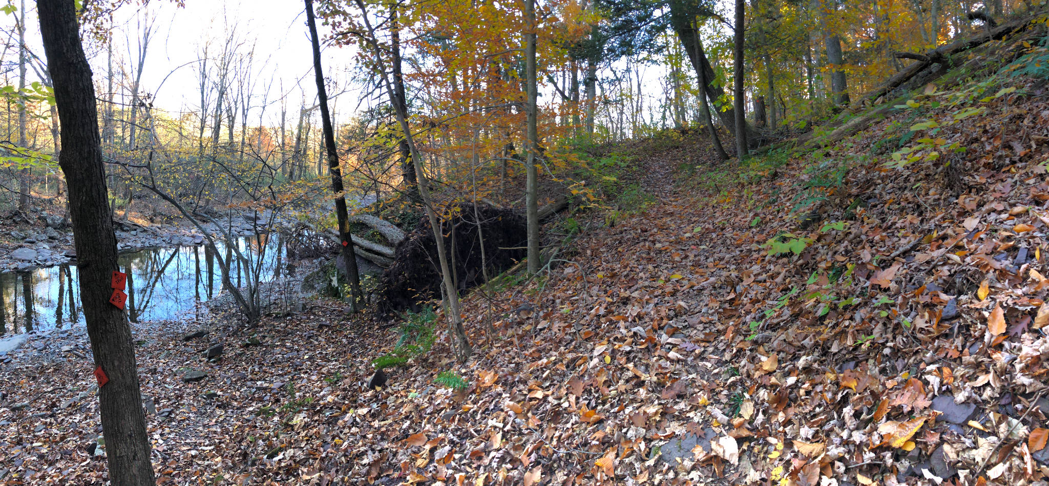
From the parking lot on Raven’s Hill Road, the the first quarter mile of Mimi’s Trail serves up a pleasant little climb that loops almost 180 degrees through some gorgeous, mature trees, crosses a tiny rill, then descends via satisfying curves to the banks of Lockatong Creek. It turns into Peter’s trail* by a lovely streamside bench, the perfect place to take a break. Combined, for 9/10 of a mile, the trails track this stream closely.
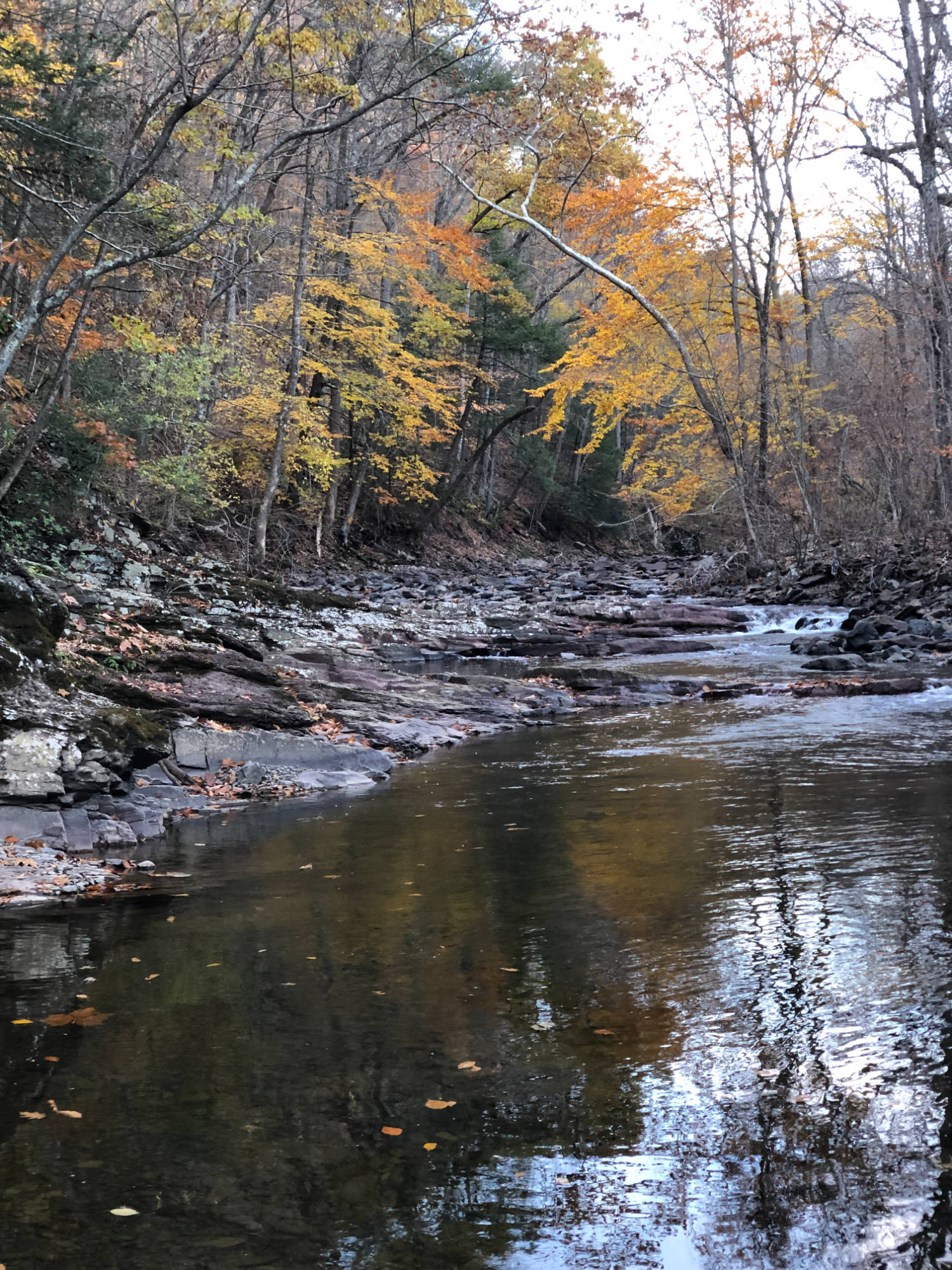
As a long time fisherman, I stopped frequently to admire the Lockatong’s structure. The water runs crystal clear and fast, with boulders, riffles, and quiet, deep pools. In fishing parlance, it’s lovely “pocket water”. While it isn’t classified as a wild trout stream, because it can’t reliably support a self-sustaining trout population, it is stocked, and the water runs cold enough that in good years trout can survive the summer and live another year or more here. On its own, the stream supports a decent, wild small-mouth bass population which tolerate somewhat warmer water than do trout.
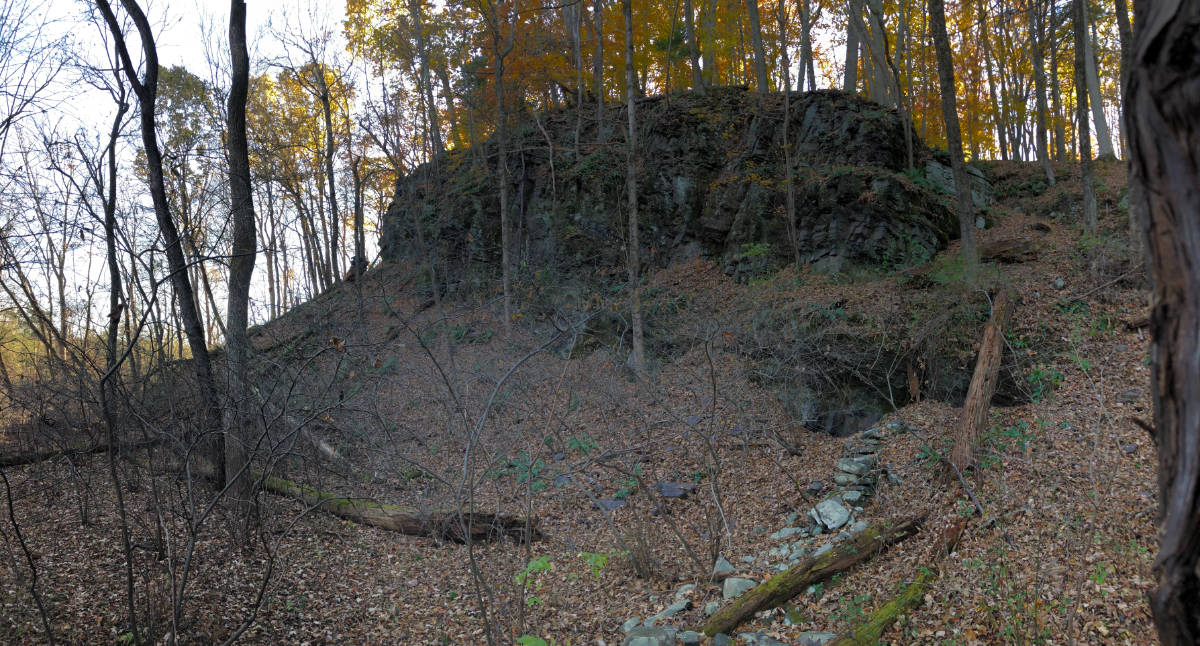
Then Peter’s trail turns north up the hill, winding its way behind and then above a spectacular, stream-side bluff.
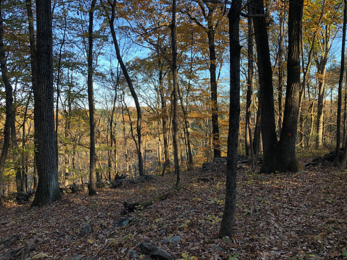
The climb starts steeply, rising 180 vertical feet in only about 900 linear feet (an average gradient of 20%). However, it doesn’t feel that steep as the footing is smooth, and the trail is laid out in switchbacks to keep the rise nearly uniform. The final 70 vertical feet is much gentler, but here you’re tracking along the top of a steep slope, with partial views of nearby ridges through the trees, and views steeply down to the Lockatong, with a few feet of safety margin. I normally don’t suffer from vertigo, but on my return I had to stop and gather my wits before continuing towards what appeared to be a sheer drop-off just past the trail. Having just walked up the hill, I knew there was nothing dangerous here, but the illusion of an open drop was still strong.
Really, my only criticism of this trail is that it’s linear. Unless you want to walk back on paved roads, you have to return the way you came. Personally, though, I enjoyed the back and forth hike as the views heading predominantly south and west were quite different from when I’d been walking east and north.
Another option is to set up a car shuttle, leaving one car at the Strimples Mill Road parking lot, at the end of this trail, and starting the hike near Bull’s Island on the Delaware River. The White Oak Trail takes you up from Rt. 29 more than 200 vertical feet to within a quarter mile of the Zega Lockatong Preserve trailhead. Combined it would be a 1-way hike of 3.6 miles, climbing 450+ vertical feet. Not bad for central NJ!
*Mimi’s trail is named after the late Mimi Upmeyer, a founding member of the Land Trust, and Peters’ trail, after Ralph Peters, the former owner of the property.
Renate
Wonderful trail! Well marked.